Tracking Floods Through Open-Source Innovation
/January 20,2026/
Of the more than 250,000 rivers in the United States, only about 12,000 are actively monitored by the U.S. Geological Survey (USGS), leaving many communities vulnerable to flooding without warning. As extreme weather gives rise to more frequent and severe floods, real-time river monitoring becomes more critical than ever.
Open-source technology could help fill the monitoring gap. Inexpensive and easy to use, open-source hardware is changing what’s possible, giving the water industry new tools to expand monitoring, share insights, and build more informed, efficient, and sustainable operations.
For Reservoir partner Stroud Water Research Center, open-source hardware allows researchers more flexibility in how they measure, record, and report water levels in rivers across the country. Stroud Center scientists and engineers, in collaboration with USGS, created the Open-Source River Camera and Altimetry (ORCA), a compact and inexpensive unit that transmits photos and data to the cloud, allowing personnel to view river photos alongside water level measurements in real time.
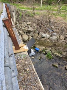
While commercial versions of similar devices exist, ORCA stands apart because it is open source. Its plans are freely available, allowing anyone to adapt the device to meet their specific needs. For USGS, ORCA data is managed through Amazon Web Services and the National Imagery Management System. For users working outside the federal government, ORCA measurements can be viewed in real time through Monitor My Watershed.
With ORCA and other open-source technology, collaboration drives progress. Through transparency and user freedom, open source enables researchers and engineers to connect, collaborate, and build on shared improvements across online communities, such as the Stroud Center’s EnviroDIY initiative. And when anyone can share knowledge through accessible data, the benefits extend to everyone.